Mosborough folk are not prone to rioting, not now, not ever; but one thing they are passionate about is their School. In 1791, their School was under threat.
The occupier of Mosborough Hall, Thomas Stones (1726-1797), was the grandson of the School’s founder, Joseph Stones (1639-1680). In 1791, Thomas was in financial difficulty. In a final act of desperation, he had sold Mosborough Hall and was about to move to Chesterfield. Before he left, he had sold or let the land belonging to the school endowment so that the schoolmaster, John Fox, would get no benefit from it. Stones had nominated John Fox for the appointment some 20 years earlier in 1770.
Now the School was in crisis. Replacement trustees had not been recruited to manage the School for years, and the appropriate transfers of land ownership to the present trustees had not been made. Inevitably, the community associated John Fox with this state of affairs, and in 1791, matters came to a head.
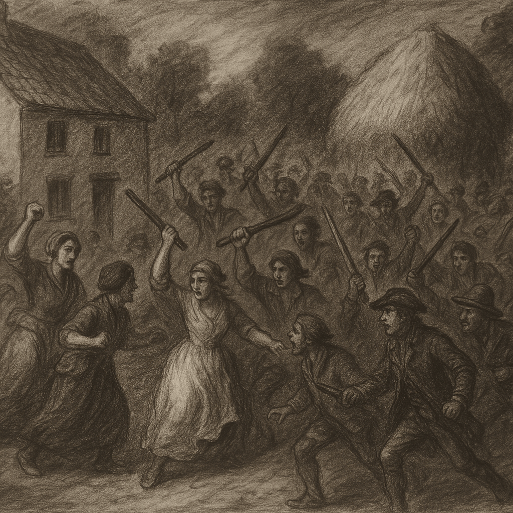
A crowd assembled outside his house on School Street, and a riot ensued. These were not the type of troublemakers one might expect, but rather some of the leading figures in the local community, among them Joseph French, farmer; John Story, shoemaker; Frances Webster, spinster, John Cowley, sicklesmith; George Story, shoemaker; Elizabeth Horner, wife of George (nailer), William Hobson, farmer; Sarah Taylor, wife of Thomas (mason), James Cowley, scythesmith; Joseph Webster, shoemaker; George Hutton, sicklesmith; William Gray, yeoman; John Gray, grocer; William Rose, wheelwright; John Bradshaw, maltster, George Thompson, schoolmaster and George Gosling, constable.
John Fox, along with his brother Jonathan and father Stephen, were assaulted in the process. His stack of hay was pulled down and some of it was taken away. George Gosling was also assaulted while attempting to keep the peace.
John Fox was forced to leave the School House, and George Thompson was appointed in his place.